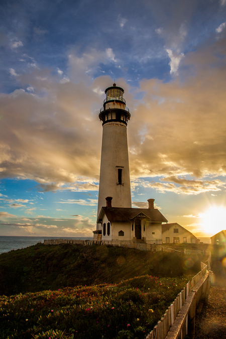

Along the coastal highway in California, north of Santa Cruz but south of San Francisco, sits a lighthouse. You can see it from miles away. It is actually the tallest lighthouse in California. It is perhaps the most picturesque lighthouse on the western coast of the U.S., and one you should visit if you get the chance. I’ve been there a few times and will show you some of the ways you might photograph it when you get there.
What is Pigeon Point?
In 1853, a ship called the Carrier Pigeon was on its maiden voyage from Boston to San Francisco. Because the Panama Canal had not yet been built, the ship had to go around Cape Horn, which are the most treacherous waters in the world. It did so, and then made its way up toward San Francisco, where it proceeded to wreck about 50 miles from its destination. The wreck happened on a rocky promontory that was henceforth called Pigeon Point. A scant 18 years later, a lighthouse was built on that rocky promontory to ensure nothing like that happened again.
The lighthouse is still active, although it is not manned and tours are not allowed. The buildings around the lighthouse are now a youth hostel, and the grounds are preserved as Pigeon Point Light Station State Historic Park.
Where is It?
Pigeon Point Lighthouse is located on Route 1 (Cabrillo Highway) in San Mateo County, California. It is 27 miles north of Santa Cruz and 50 miles south of San Francisco. It is right on the main road and you can see it from a few miles away whether you are coming to it from the north or the south.
Separately, I have written about Grey Whale Cove, which is 44 miles north of this lighthouse. Both could be visited in one day. In fact, if you ever find yourself in the area, an outstanding day of photography would be the 75 mile drive up the coast between Santa Cruz and San Francisco. There are a number of great stops along the way.
Itinerary for Drive Between Santa Cruz and San Francisco
A visit to Pigeon Point can be part of a larger excursion to the California coast between Santa Cruz and San Francisco. My recommended approach for doing so would be:
- Start in Santa Cruz
- Make your way up Route 1 toward Davenport. Starting in about 10 miles, there will be several places to pull off and walk to cliffs, The views and cliffs are dramatic and worth visiting by themselves.
- Keep heading north on Route 1. After another 16 miles you will come to Pigeon Point Lighthouse.
- After photographing Pigeon Point, head north on Route 1 again. Stop at Pecadero Beach (about 6 miles up the road) and San Gregorio State Beach (another 4 miles).
- Keep heading north on Route 1 and stop in Half Moon Bay (11 miles north) for something to eat and to photograph the marina.
- About 8 miles north from Half Moon Bay is Montara Beach. There is also a lighthouse in Montara worth photographing.
- Just another mile north from there is the aforementioned Grey Whale Cove. You will have to walk down a large set of wooden stairs to reach the beach, but it is worth it.
- Another mile north from there, just before entering the tunnel, there is a turnoff and parking on your left. Pull in there, and there is a walking trail with coastal views called Devil’s Slide Trail.
- From there, Pacifica Beach is 7 miles north. There is a trail and huge rocks to photograph there.
- After that, you are only a half-hour south of San Francisco. Conclude your day there with a nice dinner.
It doesn’t get much better than that!
How to Shoot Pigeon Point
Ok, back to Pigeon Point. Now let’s talk about how to photograph it.
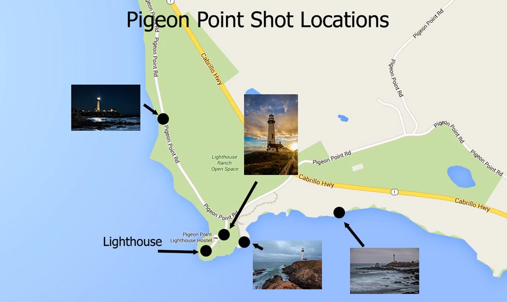
You’ll notice that the pictures of Pigeon Point in this article have been taken from several different angles. There is almost no bad angle to shoot Pigeon Point Lighthouse.
If you park at the lighthouse, just to the south there is a little overlook. Go there first. Here is what it looks like courtesy of Google Maps Street View:
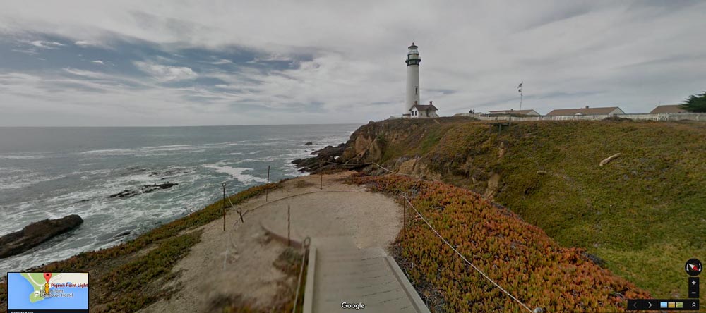
Use a wide angle lens here so that you can get as much of the rocks and surf below you as possible. To make the foreground great, you may have to step outside of the ropes (but be careful if you do – there is no sense dying over this shot). Here is a shot I took from this location:
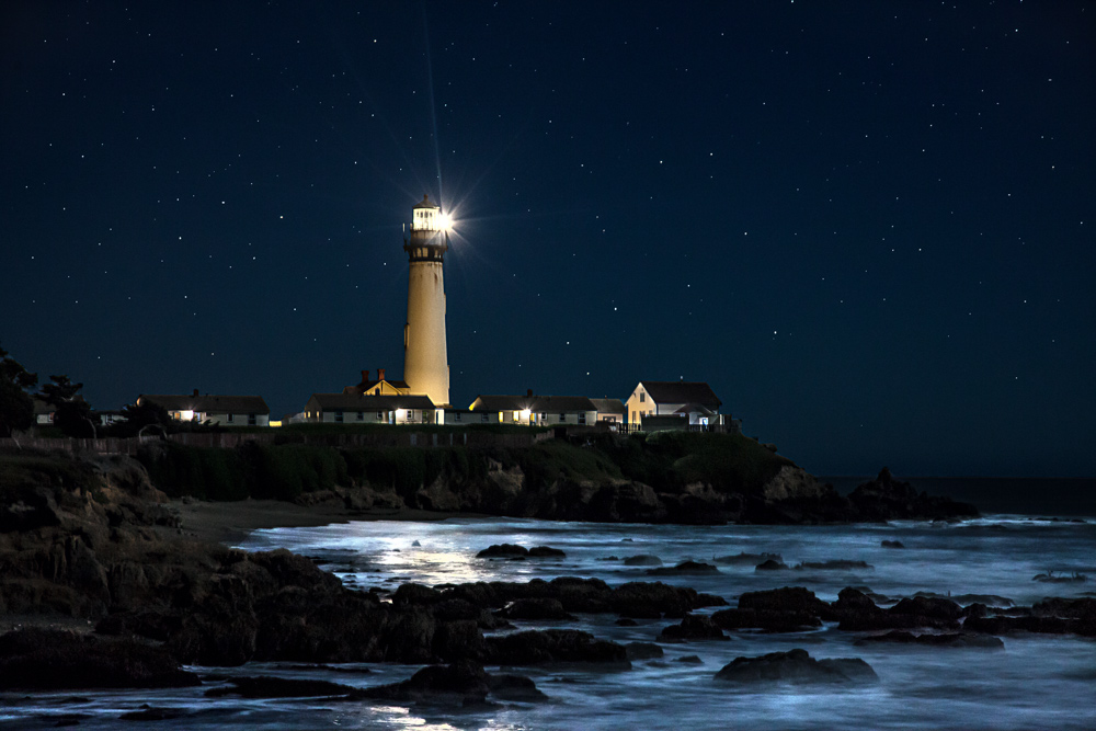
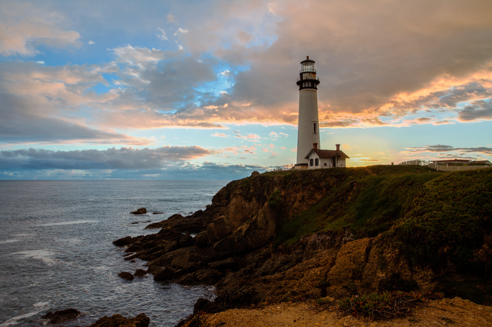
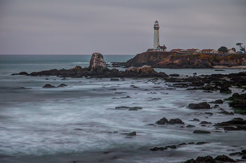
That’s the easiest and most obvious place to photograph Pigeon Point, but it isn’t the only place. There are plenty of spots to the north and the south to photograph it. You might notice that the night shot above was taken from the north. This shot was taken from the south:
Best Times to Shoot
The best time to shoot Pigeon Point is anytime there is no mist or fog. That whole area of the coast is likely to be wrapped in mist much of the time, and it can be frustrating.
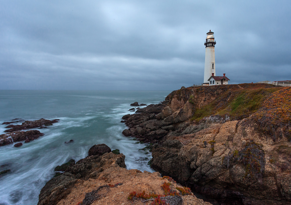
If you do have good weather, it would be best to enjoy a sunset at Pigeon Point. The sun sets in the west, so you can get the sun in the picture at that time. The first picture in this article was taken at sunset, so you can get an idea of the angle of the sun. After that, you can wait around for a while and get some night shots. Pigeon Point is still an active lighthouse, so you can photograph it in action at night.
I’d love to show my fotos of Pigeon Point, though they’re not nearly up to the images shown here. We pass by annually on the AIDS Ride from SF to LA in June. Dramatic and picturesque. I love this page as a guide to shooting the lighthouse, with best times and locations and lens choices.
Thanks Steve! Glad you like it. I think you should be able to upload images in the comments. Give it a try! If not, maybe you could just post a link. I would like to see them, and would like for people to be able to add their pictures of these places to make this a better resource for others.
Here you go: an album on Flickr: https://www.flickr.com/photos/swedg/albums/72157641102974664